Author Archives: friendsofcarringtonmossgmailcom

The Greater Manchester Green Belt Lie!

There has been lots of commentary about Stockport’s withdrawal from the Greater Manchester Spatial Plan (Places for Everyone, or PfE) since they made the decision in 2020, especially about the consequential risk that being out of the plan will lead to more Green Belt release and speculative development.  The same threats are being made to those who, more recently, want to remove Oldham from PfE, with some Councillors suggesting the arguments in favour of withdrawal are misleading residents and that this approach “would lead to further developments on the greenbelt”.

Breaking News!

It doesn’t matter whether you are in or out of PfE that risk is still there.  Trafford’s rejection of a Battery Energy Storage System (BESS) on retained Green Belt has been approved on appeal by the Planning Inspectorate, despite participation in PfE that supposedly gave protection to that land!

Given the £millions of public money spent on Places for Everyone over the more than 10 years it took to bring the plan to fruition, why hasn’t the media picked up on this issue and who is auditing this failure to achieve even the basic aims of the plan?

Places for Everyone is supposed to be a brownfield first plan, it is supposed to protect retained Green Belt from development, it is supposed to help resolve the housing crisis in Greater Manchester. 

Green Belt allocations are coming forward across the region (much reported in local press and the MEN) and are being approved in advance of all the swathes of brownfield land available for development (despite huge amounts of public money being made available to regenerate that previously developed land).

Retained Green Belt is not protected by participation in the PfE plan. In the particular case mentioned above, the Planning Inspector used the Government’s ‘Grey Belt’ rules to assert that it is appropriate development.  There were no concerns raised about the number of fires that have occurred on such developments, including the BESS fire in Liverpool that burned for 59 hours, or more recent fires in Essex and Aberdeen.  At least there will be plenty of water available from the River Mersey should a fire break out, but All Saints Catholic Primary school is just down-wind of the site, so alarms should be raised to alert the school and local residents if a fire or the associated toxic fumes are released.  Nothing was mentioned about this by the Planning Inspectorate, which seems to be blindly allowing as much development as possible to support the Government’s war on nature and communities.

There are many ways to resolve the housing crisis, none of which require the release of Green Belt.  These are outlined in the Community Planning Alliance Homes for Everyone Report

The Government and Greater Manchester’s leadership are explicitly ignoring the data that shows:

  • There is sufficient brownfield land available to deliver at least 1.2m homes nationwide
  • There are 1.55m empty homes across England and Wales (including 70,000 homes owned by councils and housing associations)
  • There are an estimated 165,000 empty commercial properties that could be turned into houses and/or flats
  • More innovative solutions could also be looked at, such as promoting the 26m empty bedrooms in the UK that could provide income for the householder and a place to live for someone on a waiting list.

Shockingly, there are many sites which have been granted planning permission but have not been developed that could provide over 1m new homes – yet there is no impetus from the Government to ensure these sites are brought forward BEFORE any Green Belt is released.

Finally, the biggest issue with the housing crisis is the lack of genuinely affordable homes (social or Council housing).  This is an issue that has been disregarded for many years and the current Government has not even set a target to ensure Councils increase the number of these homes to address the huge and growing waiting lists.  Places for Everyone should have been renamed ‘Places for those who can afford to buy’ because the target for all affordable housing was removed from policy during the modifications process and the target for social housing was removed from the plan altogether!

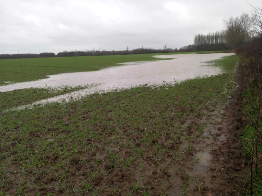
We have frequently highlighted the impact on nature’s recovery, climate mitigation and our future food security when Places for Everyone was adopted by the Greater Manchester leadership in March 2024.  The consequence of the loss of environmentally and ecologically rich Green Belt land which provides all these benefits, along with the other issues set out above, shows the extent of the betrayal of future generations that is now becoming increasingly obvious.

The Planning and Infrastructure Bill (published by the Government on 11th March 2025) intensifies the Government’s war on nature and communities by reducing democracy and weakening protections for flora and fauna.  It introduces Spatial Development Strategies, similar to Places for Everyone, but without the consultation previously required.  We’ll say more about this in a future blog, but it appears to be yet another Developer’s Charter, as someone else succinctly put it – another Government initiative providing

Developer Net Gain!

Call for Action 2 – Carrington Relief Road!

There have been numerous concerns raised about the route of the Carrington ‘Relief’ Road across Carrington Moss, as it will cause significant harms to both human and wildlife populations and several of our members have suggested that there is a significant lack of awareness shown by those making the decisions about this proposal. 

With this in mind, we hope you will all join us on a walk along the public rights of way near to the Carrington Moss part of the route for the new road.  We plan to meet on Dainewell Park on Saturday 8th February at 2pm. 

We’d like you to invite your Councillors and your MP to join us on the walk, so we can share our concerns.  If you are not sure who your Councillors or your MP are, click on this link to find out.  You just need to put in your post code and, hey presto, the information is there.  When the details come up, you will see a link at the right-hand side which says “Write to all your Councillors”.  You can drop them a note and invite them to come along.  If you click on your MP’s name, you can also send an email to him inviting him to come along and hear your concerns about the road.  The more invitations the politicians receive, the more likely they are to join us on the walk.

As we mentioned in our previous blog (Call for Action 1 Respond to the Consultation), the Friends of Carrington Moss welcome the long-awaited opening of the A1 route through the employment area of Carrington, but all HGVs should be required to use that route, rather than travelling along the A6144 through Carrington Village.  The CRR consultation confirms that “HGVs will not be banned on the A6144” but this should be challenged in consultation responses. 

It is disgraceful that Trafford Council have enabled the current situation being experienced by Trafford residents living in Carrington, including the air, noise, light and vibration pollution they are suffering day and night.  During the past more than 10 years of planning for unviable and unsustainable growth here, Trafford Council has not identified and/or committed funding for sustainable passenger and freight transport solutions for the area.  This is particularly shocking given the anticipated number of HGVs using local roads each day, including those that will carry hazardous materials.  There are various alternative options Trafford could have considered, including using the former railway lines, the Manchester Ship Canal and the potential to deploy pipelines (there are several of these in the area already)!

We do, though, have major concerns about the part of the route which runs across Carrington Moss.  Not just because of the impact it will cause to Sale West residents and the lack of benefits to surrounding communities, but also because of the harm it will cause to the 335-hectare peat moss (described by Natural England as irreplaceable and restorable), the productive Grade 2 agricultural land, the extensive woodland and the wetland habitats.  All of which are essential to a sustainable future for our children and grandchildren.  The road, and the wider plans for New Carrington, will also significantly impact 15 sites of biological importance and a site of special scientific significance.

Click here to join our online public meeting on 28th January at 6pm to discuss these issues further.  All are welcome.

Finally, despite highlighting previous inaccurate, incomplete or misleading information in CRR materials, the consultation resources (letters and website) have yet more examples.  We will be requesting a further Call for Action from local communities.  Look out for our next blog for more information on this.

Call for Action 1 – Carrington Relief Road!

Respond to the Consultation

As the first Carrington Relief Road (CRR) consultation goes live today (20th January 2025), we are issuing our first Call for Action to local communities.  Please take the time to respond and encourage friends and family to participate too.

The consultation period includes some face-to-face sessions, and we hope you will be able to attend one of these.  Just a reminder that the current CRR team are NOT responsible for the decisions made in the past and that they have been directed to give a very limited scope to the consultation, which is only based on the design of the road! 

The inadequacies of this consultation have been determined by Trafford Council, and they have repeatedly rejected our requests for communities to be able to influence the wider aspects of transport solutions for the area – our next Call for Action will address this failure (see below).

This consultation ends on 28th February.  Your inputs are extremely important, so do click on this link to read Trafford’s materials and submit your own response.  We will be discussing this consultation at our next online public meeting on 28th January (6pm), the link to the meeting is here and all are very welcome to join us.

At the meeting, we will highlight some of the key points to consider, which include the following:

  • there are two parts to the Carrington Relief Road (CRR):
    • we are totally supportive of the upgrading of the A1 route in Carrington (this runs through the employment zone from Isherwood Road to the A6144 near Saica Paper), all HGVs should be encouraged to use this road, rather than the A6144 through Carrington Village – this could have come forward years ago without any objections!

    • we are totally against the development of the road across Carrington Moss and have been proposing our alternative to Trafford for the last 4 years, without success – they are only interested in promoting the CRR, despite its escalating costs – it is a commitment to support development – not a solution aimed at benefiting existing communities
  • how the current design ‘benefits’ communities:
    • Carrington residents will only benefit from this new road if through-traffic and HGVs are unable to use the A6144 through the village, with appropriate traffic calming mechanisms put in place (otherwise, residents here will just be surrounded by constant traffic and the associated pollutant impacts)

    • Partington and Warburton residents will, sadly, not benefit from the scheme – Trafford has acknowledged that the road will induce additional traffic, much of which is likely to continue through Partington and Warburton, seeking an alternative route to the motorways, furthermore, given the low levels of car ownership in Partington, a new road will not reduce the isolation of this community (unlike a tram/train connection)

    • Sale West residents will be the most negatively affected by the scheme, they will suffer from huge increases to air, noise, light, vibration and water pollution, a significant, intensified and more frequent risk of local flooding, and the loss of the current safe, healthy and pleasant traffic-free recreational routes – we recognise that the recorded and unrecorded public rights of way will still be there, but, with the road solution, residents will be walking, cycling and horse riding next to the over 40,000 motor vehicles expected to use the road each day (including over 3,000 HGVs) – the number of vehicles will significantly increase from the current traffic numbers due to the proposed developments in the area and the induced traffic using the road as a ‘rat-run’!

    • Urmston residents will not benefit from the scheme either, but they are also likely to see an increase in traffic on their local roads and the risk of local flooding will increase due to the loss of water capture and storage on Carrington Moss (we do not believe the proposed attenuation ponds will be sufficient to replace the capacity lost when the road is built)
  • how the design ‘mitigates and compensates for the impact on the natural environment’:
    • the part of the road that cuts across Carrington Moss will severely impact red listed birds (including, for example, the skylark, which is prevalent along the route of the road) and protected/endangered species – we are very saddened by the thought of yet more roadkill!

    • the road will fracture the corridors used by wildlife and birds to access food and water sources – this will result in further depletion of their species

    • the road will also damage the peat moss (a restorable 335-hectare irreplaceable habitat according to Natural England) and the sites of biological importance/site of special scientific interest, even where these are not directly impacted – this is because of the changes to hydrology that will be required to keep the road water-free

    • it is likely that Trafford will consider that the attenuation ponds will replace the immense water capture and storage functionality of the moss – we think they underestimate the level of water captured here and this could lead to huge risks for local communities

    • Trafford is also likely to assume that these pond areas will create biodiversity gains, but what must be considered is that the losses will be experienced immediately, whereas any gains could take years to deliver, and, in that time, species will be lost to the area forever

    • the road will also impact the potential opportunities to support the Local Nature Recovery Strategy

    • the loss of productive Grade 2 agricultural land will impact future food security as this cannot be replaced elsewhere in Trafford
  • how the design constrains the development of the New Carrington Masterplan which is currently under development and covers the whole allocation area:
    • the CRR will significantly restrict and constrain what is possible in terms of recreational, ecological and natural capital benefits for the Sale West area, considerably increasing the inequities of access to green space for residents

    • the Natural Infrastructure Strategy underpinning the Masterplan has not yet even been discussed – this should determine the approach to mitigation and compensation for environmental and ecological harms to be caused across the allocation area (including the cumulative harms) – such issues should not be addressed as piecemeal solutions for individual developments, including the CRR.

Whilst we are keen for residents to respond as constructively as possible to this consultation, we also need to recognise that Trafford has not given communities the opportunity to influence either:

  • the choice of transport options for this area (why weren’t we asked if we wanted trams or trains, given the size and scale of the developments they are proposing, the number of years this has been under consideration, and the sheer common sense that we should make full use of the former railway lines running through the allocation area and the proximity of the Manchester Ship Canal?), or
  • the route options for the road.

You might want to mention this in the final section of the response questionnaire (headed “Further Comments / Queries), but with these things in mind, there will be a future Call for Action from local communities to address the total lack of previous consultation about the CRR. 

Look out for our next blog for more community action on the Carrington Relief Road Consultation.

What exactly is the Vision for New Carrington?

Houses on stilts?  An estate by the lake? HGVs replaced by boats (well we like that idea)!

The recent heavy rainfall event significantly impacted many in our communities (and beyond), not only causing disruption to travel and a lot of inconvenience (wonder who’ll be jailed for that*) but also, very sadly, causing the deaths of wildlife and domestic animals.  The Manchester Evening News (2nd January) reported that 1,000 people were evacuated from their homes and several major roads were under water and closed for a long period. 

Whilst Trafford was “working closely with the Environment Agency, fire and rescue services, and the police to provide support to those in urgent need”, there was a huge amount of community support too.  Thanks to everyone who did their bit, particular thanks to Carrington Riding Centre for their support to those affected (humans and animals).

Despite the Environment Agency issuing six flood warning and four flood alerts, the Mayor of Greater Manchester, Andy Burnham, astoundingly stated that the severity of the flooding took authorities by surprise because no specific warnings were given!  He has called for “accountability”.  We wonder what he actually means by that.

Will he and his colleagues, the leaders of 9 districts in Greater Manchester, be held accountable, for example, for their decision to allocate land that is essential for climate mitigation in his Places for Everyone Spatial Plan.  One of those allocations is New Carrington, in which Trafford Council proposes to approve the development of 5,000 houses, 350,000m2 warehousing and 4 major new roads! 

These developments will mean that huge swathes of land that is currently capturing and storing thousands of litres of water will be concreted over, against the wishes of local communities, causing significant environmental and ecological harm and causing enormous risks to future generations (and not just in relation to flooding).

There is a lack of understanding at Trafford Council about just how much water is hosted by Carrington Moss.  This area has saved local communities from more severe flooding for decades.  You can see some of our videos showing the extent of flooding in previous years on the Carrington Lake page of our website.

The Met Office (and many others) have reported that rainfall is now heavier and more frequent than in the past.  Their scientists found that “rainfall associated with storms is becoming both more intense and more likely”.  Whereas we could, at one time, expect such events to be once in 50 years or so, those extreme weather conditions are now expected to occur at least once every five years. 

This means that wetland habitats, like Carrington Moss, are hugely valuable for the ecosystem services they provide. 

What is really worrying many in existing communities though, is that, if this very wet land is developed, future heavy rainfall events will not have the benefit of Carrington Moss to protect local areas.  Once a flood event has happened to their homes, residents will find it difficult to get insurance and there will be huge costs to the public sector (which is funded by us). 

Much of the land that is proposed for development is under high levels of water.  The Council and developers will tell residents that they have a sustainable drainage strategy but let’s be clear, draining all this water into the River Mersey (or Sinderland Brook) will cause local and downstream flooding.  This is contrary to national guidance and our concerns about this issue have been repeatedly ignored by Trafford, the Greater Manchester Combined Authority and the PfE Planning Inspectors. 

Will they all be held accountable for future flood events that occur here and in surrounding communities?

Many of you will have seen the Manchester Evening News article that reported the closure (once again) of the A555 Airport Relief Road, which had cars submerged to their rooftops!  Transport solutions such as this do not benefit anyone, and as Trafford themselves admit, the new road here (Carrington Relief Road) is expected to induce additional traffic into the area (definitely not what we need). 

We are currently expecting the consultation for the Carrington Relief Road to be issued later this month.  Please keep this flooding in mind when you respond.  We believe our alternative option is a more sustainable solution that will benefit both current and future residents. 

For more information about our ongoing campaign, please sign up to our monthly newsletter here and join us at our monthly online public meetings.

Note: Image credits Rob Duncan, Mary Lennon and Tony Shearwood

*for anyone who does not understand this reference, protestors who cause inconvenience to others by, for example, sitting in the road to raise an issue, can be jailed – yet those who knowingly make decisions that result in far more serious implications, such as planning for or approving development in areas that should be capturing flood water, putting current and future communities at real risk of harm, currently escape any accountability or punishment!

Risk to your local peatmoss – YOU can help!

Carrington Moss is Trafford’s largest peatland and is one of several across Greater Manchester.  Peatlands which store vast amounts of carbon – the worlds peatlands store twice as much carbon as all the world’s forests. Carrington Moss is a unique biodiverse habitat, home to an abundance of flora and fauna. It is the breeding and feeding grounds for many endangered wildlife creatures and birds, some of which are red listed.

Carrington Moss is a wetland that absorbs huge amounts of water and it is very wet for long periods each year. This is great news because the water keeps the peat active, holding in, rather than emitting, the carbon stored here. It is also our natural flood defence.  Without it, both local residents and communities downstream on the River Mersey are at a higher risk of flooding.

Trafford Council have plans to concrete it over!

The council want the construct the £76 million Carrington Relief Road, which they say is NOT for the benefit of local residents. They also say it will INDUCE more traffic into the area.  Our recent surveys demonstrate that this is money poorly spent.

There are NO committed plans for investment in public transport in the area, so any new development will be unsustainable and levels of air, light, noise, vibration and water pollution will increase significantly.

The council want to build 350,000 square metres of warehousing and industrial units, in Carrington, of which 100,000 square metres will be on (formerly Green Belt) land that has peat of around 2m in thickness under the surface!  Yet, there are sufficient brownfield sites for those developments across Greater Manchester.

The council want to build thousands of houses on the moss when there are sufficient brownfield sites in the borough and beyond!

There are several ways you can help our campaign to protect this precious habitat

  • Email your councillors to express your objections
  • The Carrington Relief Road Consultation will be in January 2025.  You can respond to this consultation, details of which should be available on the council website. 
  • Alternatively, subscribe to our free newsletter and we will keep you updated.
  • Join our 200 Club lottery for just £22 a year.  Not only do you have the chance to win one of three cash prizes each month for 12 months, but you will also be helping us with our campaign.  Last month’s prizes were £74 (1st), £44 (2nd) and £15 (3rd).  The more members we have, the higher the prize money, so do encourage your friends and family to join too.

Unsustainable New Carrington – “Trapped Behind the Wheel”

by Lorraine Eagling

Where we live and how we get around are key to what shapes our everyday lives.  A recent New Economics Foundation (NEF) report ‘Trapped Behind the Wheel’ found that

far from moving our economy towards sustainability and improved wellbeing, England’s new homes in recent years have increasingly encouraged car-dependent lifestyles.

One factor in this change has been the outsized share of new homes being built in rural areas, which has risen continually across the country in recent years”.

New Carrington will be one of these car and HGV-dependent developments that will not be sustainable, nor will it deliver improved wellbeing for new and existing residents.  The majority of the housing and warehousing will be located on grade 2 agricultural land and part of a restorable 335 hectare peatmoss! 

Despite the proximity of New Carrington to Partington, Carrington and Sale West, there is currently a lack of adequate public transport and no committed funding for new public transport infrastructure.  In fact, there are no plans to connect New Carrington to the water, rail or tram network, despite the allocation being adjacent to the Manchester Ship Canal, having former railway lines running through the site and it being the largest development in Greater Manchester.

The Council are pushing ahead with this plan regardless of the experience of the past 15 years, which shows us that, without substantial changes and investment into new public transport infrastructure, there is a major risk of locking in increased car and HGV dependency for decades to come.

As a result, Trafford Council and the Government will not be able to deliver priorities such as

Bringing the cost of living down to more manageable levels, reducing spatial inequality and responding adequately to the climate emergency

In most cases, residents in New Carrington will face the higher costs of car dependent living. Their ability to enter paid employment or the training needed to secure a well-paid job is constrained by the availability of local public transport infrastructure.  

Although there are plans to improve bus services as part of the masterplan, Partington, Carrington and Sale West have seen bus services reduce significantly over recent years, so any increase in services provides no net gain overall. 

“A 2021 study demonstrated that in ‘left-behind’ neighbourhoods, which have high deprivation and poor social infrastructure provision, public transport is worse than average (74% have no railway station and bus journeys per capita have declined faster than the national average). Residents are less able to afford to compensate by owning a car (40% of households have no car, compared with 26% across England). These areas of the country typically have worse connectivity than the English average but rely more than other parts of the country on their local bus service”. (Emmet Kiberd, Benedikt Straňák, NEF, November 2024)

So, why is there no commitment to invest in new public transport infrastructure such as reopening the rail line between Irlam and Timperley?  Part of the answer may lie in the following figures.

“The public transport system in wealthier parts of the country, such as London and the south-east, is much more effective and gives residents there far more access to jobs than the equivalents in the north-west, Yorkshire, and parts of the Midlands. Despite this, public investment in transport has tended to overlook the parts of the country where it is most needed. The north of England would have received an additional £51bn in public investment in transport if it had matched the per capita level seen in London from 2014/15 to 2019/20. Similarly, investment in active travel infrastructure between 2016 and 2021 was £24 per person in London but only £10 per person in the rest of England. (Emmet Kiberd, Benedikt Straňák, NEF, November 2024)”

Regardless of the lack in funding in the north for public transport, Trafford Council plan to build a relief road (the name is misleading), with a current cost of £76million, which is very likely to rise! 

Why isn’t this money being used for new public transport infrastructure? If the Government is to deliver on its priorities, when there is a ‘black hole’ in public finances, surely public transport must take priority over road building.

Then, there is another question, why is Trafford pushing ahead with this development when there are other available sites and enough windfall sites over the past four years to provide 40% of the housing target for New Carrington? 

Emmet Kiberd and Benedikt Straňák (NEF, November 2024) suggest the reasons behind these questions are

  • “Favour cheaper greenfield land in a profit-driven housing development system.
  • Relatively lower levels of local political opposition to new developments in more remote areas.
  • A lack of early, integrated planning of transport, housing, and development sites, reinforced by substantial underfunding of public planning departments.

The provision of public transport and active travel for new homes is affected by:

  • The insufficiency of Section 106 funds to cover the public transport needed, together with the lack of negotiating power for councils tends to see transport provision lose out in a trade-off against social housing, community facilities, and other items.
  • The use of large amounts of public funding on expensive road infrastructure alongside new developments, encouraged by a lack of advance transport planning and car-centred approaches.
  • The provision of public transport and active travel for new homes, which is affected by poor public transport and active travel provision in adjacent neighbourhoods, due to congestion and a lack of safe walking and cycling routes”.

Clearly, there is a need for ambitious policies and brave decisions in relation to the New Carrington Masterplan because the second-best solutions that present themselves are unlikely to solve the problems and deliver the priorities that will bring the cost of living down to more manageable levels, reduce spatial inequality and respond adequately to the climate emergency.

Trafford has available sites for affordable housing, so why are they not being built?

by Lorraine Eagling

The New Carrington Masterplan will result in the loss of a 335-hectare peat moss, Grade 2 agricultural land, woodlands and wetlands which will have dire consequences for local biodiversity and Trafford Council’s ability to be net zero by 2038.  These important habitats are to be concreted over and replaced with 5,000 houses and 350,000sqm of warehousing.

There is no doubt that there is a crisis in the availability of genuinely affordable housing (that is social/council housing) but Trafford and Greater Manchester appear to be planning to continue to build for investors, second home owners and airbnbs!

Building on a peat moss is not the solution to the affordable housing crisis.  Research from CPRE has shown that there are enough ‘shovel-ready’ brownfield sites in the UK for 1.2 million new homes, which will make a significant contribution to Labour’s goal of 1.5 million homes.

The Labour Government recently published five golden rules for house building which were articulated in their proposals for the updated National Planning Policy Framework.  They propose a sequential test which makes it clear that schemes must look to brownfield first, prioritising the development of previously used land wherever possible.

There are numerous suitable, local, brownfield sites, some of which are Council owned, that could be developed in advance of concreting over land that contributes to climate mitigation, nature’s recovery and our future food security.  These brownfield sites could provide much needed social housing, which is not what is proposed for the former Green Belt land on Carrington Moss. 

Here are some examples of such Council-owned sites, that are ready to be developed and are in locations that are serviced by good public transport links and local amenities (unlike the isolated area that is Carrington Moss, which the Council acknowledges is poorly served by public transport).

  • The former Depot on Higher Road, Urmston – this site has been lying empty for a number of years.  Following a freedom of information request, Trafford Council confirm this site was sold to a private developer.  To date, there have been no planning applications submitted for this site. 
  • The former Woodsend Primary School, Flixton – this site has been lying empty for a number of years.  Following a freedom of information request, Trafford Council confirm that they are looking at options to deliver homes on this site and would expect to make a decision within the next 12 months. 
  • Sale Magistrates Court, Sale – this building was demolished a number of years ago and the land sold to a private developer who submitted a planning application in December 2020.  To date, no building work has commenced.

In addition to these Council-owned sites, there are many other brownfield sites in Trafford awaiting development, as identified in the Council’s own Strategic Housing Land Availability Assessment (known as a SHLAA for short).

In response to our freedom of information request Trafford Council said

‘Delivery of homes including affordable homes is a priority for the Council. The Council is prioritising the delivery of homes at Council owned sites including Tamworth (Old Trafford), Former Sale Magistrates Court, Chapel Road (Sale) and Stretford Town Centre.

We also have a need to invest in other assets and services that benefit our communities. For example the Council is investing in its leisure portfolio which includes improvements at Urmston, Altrincham and Partington Leisure Centres. The receipts from land sales such as Higher Road Depot are part of the funding for these activities.’

We await progress with interest but, given that planning applications are already coming forward on former Green Belt and greenfield land, there is no doubt that the Brownfield First policy is NOT what is being pursued in Trafford!

Concerned about traffic? Email your Councillors about the Carrington Relief Road!

Whilst we await the consultation for the Carrington Relief Road (CRR), we continue to collect data and scrutinise the traffic flows in our locality.  Our analysis is very revealing! So, why are we worried about the impact of the CRR? Read on to understand our concerns.  Contact your Councillors if you are concerned too (details of your Councillors can be found here).

Trafford Council has acknowledged that the construction of this £76million road is not for the benefit of existing residents (as stated in their Carrington Relief Road Environmental Impact Scoping Report)

1.2. The key objective of the new Carrington Relief Road is to provide sufficient capacity within the transport network to deliver growth of housing and employment in the wider New Carrington masterplan area, and realise the socio-economic benefits of the future development. The redevelopment of this Site provides an opportunity to deliver a new link road for Trafford that will facilitate future phased development of c.5,000 new homes and 360,000sqm employment floorspace”.

Unfortunately, existing residents will be adversely affected by the new road as demonstrated below.  Yet, if monies were invested in public transport infrastructure, as previously promised in the local plan, there would be far greater health, economic and social benefits for both existing and new residents, not to mention the preservation of an area that supports climate mitigation, nature’s recovery and future food security.

So, why are there no plans to invest in train/tram infrastructure in what is the largest development in the Places for Everyone Plan?  It is described as the single largest regeneration scheme in the North West by Andrew Western, MP for Stretford and Urmston in his comment supporting the Wain Estates Case Study here.

Trafford Council’s Local Plan 2012 proposed to deliver “significant improvements to public transport infrastructure by improving access to Partington, the Regional Centre and Altrincham with links to the Metrolink system”.   The New Carrington Masterplan presents the perfect opportunity to deliver these much-needed improvements by directing the funding into schemes that already had the backing of the local businesses, Councils and the community, such as reopening the Cadishead Viaduct.  More information on that initiative can be found here.

Whilst we understand that funding is an issue and the Council are reliant on contributions from developers and the government, these types of schemes are long-term, sustainable solutions to the inequalities that exist in Partington, Carrington and Sale West and are a much better use of public money.  It is well documented that roads are short-term, unsustainable options.

We are already experiencing the impact of climate change, with erratic weather patterns leading to localised flooding and crop failure.  The proposals for New Carrington are contrary to Trafford’s declaration of a climate emergency in 2018 and its aims to be net zero by 2038.  The lack of funded sustainable transport options also conflicts with the Greater Manchester Transport Strategy 2040, which has a vision for 50% of trips to be made by sustainable modes, and states (page 8) that “Achieving the Right Mix is expected to lead to zero net growth in motor vehicle traffic in Greater Manchester between 2017 and 2040”). 

How will they meet these targets?

Whilst we acknowledge active travel forms part of the transport intervention in New Carrington, any progress made in getting people to choose active modes will be heavily outweighed by the significant increase in road traffic as described in their scoping report.  Walking cycling or horse riding next to over 3,000 HGVs a day will not be pleasant, safe or healthy!

The Proposed Road  

The western end of the Carrington Relief Road starts opposite the Saica Paper Factory and will run along the existing A1 Road behind Carrington Village.  This road is to be upgraded as part of the scheme.  The eastern end of the Relief Road will be constructed across Carrington Moss, from Isherwood Road to the junction of the Spur Road and Banky Lane. 

The cost of the overall scheme is currently estimated at £76 million but could rise due to the increased cost of materials, the need to address contamination and the complexity of building on or near to a 335 hectare peatmoss (hydrology issues will need to be tackled – depending on the final route).

In responding to Trafford’s ‘engagement event’ (which took place in 2021), in advance of the release of the CRR route options report, we put forward a proposal that would reduce HGV traffic through Carrington Village and negate the need to construct an expensive road across Grade 2 agricultural land, woodland and wetland habitats.

We proposed that the existing A1 Road be upgraded and opened up to all heavy goods vehicles to resolve the issue of hundreds of HGVs passing through Carrington Village every day.  We proposed upgrading the existing A6144 between Isherwood Road and the Carrington Spur, which is not at capacity, and reducing speed limits.  We also proposed upgrading the existing active travel routes across Carrington Moss.

Unfortunately, our suggestions (and those of Natural England – a national organisation that advises the government on all issues related to the natural environment), were ignored.  So, we have continued to collect traffic data and here is a summary of our findings:

Induced Traffic

Our most recent surveys focused on the pattern of traffic travelling from the west of Partington towards the M60. 

During term time, the total number of cars travelling from Warburton, Warrington and Lymm into Partington is 69% of the total number of cars recorded leaving Partington in the direction of Carrington.  During school holidays, this figure is 63%.  This shows that the majority of the traffic travelling through Partington towards Carrington is coming from outside the area.  The volume of this induced traffic will increase (as described in Trafford’s own Environmental Scoping Report – Traffic flows are likely to increase due to the improved desirability of the routeparagraph 14.46)

What proportion of traffic will benefit from the new road

At the Manchester Road/Isherwood Road and Carrington Spur/Banky Lane junctions term time figures have been used, when traffic is highest.  Full details of our surveys can be found here and here.

  • During term time 37% of the traffic coming from the M60 is headed towards Carrington.
  • During term time 40% of the traffic from Sale West is headed towards Carrington
  • During term time 53% of the traffic from M60 or Sale West is headed towards Flixton.

The traffic headed towards Flixton would not use the relief road, so ……

….. only 18.1% (an average of 47% of 37% and 47% of 40%) of the traffic from the M60 and Sale West would use the new relief road.

Furthermore – during term time ……

….. only 32% of the traffic from Partington and Carrington heading towards the M60 would use the new road, as the rest of the traffic is headed towards Flixton.

Let’s think about that – only 18.1% of the traffic from the M60 and Sale West and only 32% of the traffic from Partington and Carrington would use the CRR – yet the Council is proposing to spend £76m on an outdated, unsustainable road-based solution!

Remember:

  • Congestion in Partington will increase significantly and will have a major impact on existing residents. Not only will there be increased induced traffic as described earlier, but the construction of approximately 3600* houses in central Partington, Partington East (which is really Carrington South) and Warburton will put extreme pressure on the road network – note that these numbers do not include the additional homes recently constructed or still to be built in other parts of Partington (Lock Lane, Oak Lane, Hall Lane).
  • Congestion from Sale West to the M60 at the Banky Lane Junction is the heaviest of all routes during peak times.  This will increase significantly due to induced traffic from the relief and the construction of 1450* houses in Sale West.

* Figures taken from the GMCA Joint Development Plan paragraph 11.381.

Having your say!

If you wish to express your opinion regarding this matter, the public consultation for the Carrington Relief Road is due to commence in the coming weeks.  You can also join the discussions at our monthly online public meetings – you will find the link to the next meeting here.  As mentioned above, you can also email your local Councillors to outline your concerns.

Simister Island Road Scheme

Members of Save Greater Manchester’s Green Belt Group (including Friends of Carrington Moss) are supporting campaigners who are concerned about the plans to construct a new loop road on the M60 motorway.

But ………….. we are not experts in the examination of Nationally Significant Infrastructure Projects (NSIPs).

Luckily, our friends at the Transport Action Network (TAN) certainly are and they will be joining us at our online meeting to discuss the examination (see below).  TAN is currently campaigning to get all the unaffordable road schemes, up and down the country, scrapped, including this one.  You can help with this by writing to Transport Secretary Louise Haigh, using the TAN template (click here) to help construct your letter.  The Funding Statement (paragraph 2.1.1) confirms that the cost of the Simister Island Scheme is estimated to be around £230 million, a scandalous waste of public money!

Our online meeting to discuss the Simister Island Scheme examination will be held on 17th September at 5:30pm – all are welcome – the link to the meeting is here.

If you are one of the many individuals or groups who registered as an Interested Party for the Simister Island Scheme Examination in Public, you may still be catching up with the huge list of issues that were raised in the initial Relevant Representations (you can see them all starting on page 9 of the Examination Library).  Many of them are picked up in the Initial Assessment of Principal Issues (Annex C, page 18) of the Rule 6 Letter.

If you feel that something important you raised is not covered there, you should mention this in a Written Representation, see below for the deadline.

It appears that the recently adopted Places for Everyone Plan has not been taken into consideration, particularly in terms of the cumulative impacts of air, noise, light, vibration and water pollution, and, of course, carbon emissions but also in relation to land allocated for development.  All of which needs further scrutiny.

The next deadline (Tuesday 24th September 2024) is for Interested Parties (that is all of those who have registered to take part in the examination) to submit Written Representations (WR), with summaries for any that exceed 1500 words.  We can also make a request to be heard at a future Open Floor Hearing (OFH).  Take the time to consider whether you would like to make further comments to the Planning Inspectors, would you like to submit some detailed evidence to substantiate your original representation?

There will be an opportunity for those who are affected by the proposed Compulsory Acquisitions to be heard at a specific future Hearing but those affected individuals need to make a request to be heard by 24th September. 

It is possible that the Planning Inspectors will request further information in advance of the 24th September deadline, so keep an eye on the Project Updates as they are circulated.

Please forward this link to anyone who may be interested either in the update or in joining the meeting.

Is the Carrington Relief Road really a relief road or just a green light to major development?

By Lorraine Eagling

Following my blog about the New Carrington Transport Strategy (8th March), I decided to carry out some more traffic surveys to further clarify my findings and conclusions (you can read the previous blog here).

I carried out surveys in the morning rush hour during the Easter Holidays and then mid-term time (the week the GCSE examinations started).  This time the data was taken between 8.10 and 8.30, whereas last time the data was collected between 8.30 and 9.00.  I wanted to confirm that traffic increased significantly during term time and what direction was the traffic flowing.

The following tables show the percentage of cars and vans travelling in the different directions at the two major junctions that the relief road is purportedly to relieve.

Car and Van traffic at the Junction of Carrington Spur, Carrington Lane and Banky Lane

Percentiles of traffic flow (cars and vans) during peak times in the Easter holidays April 2024 – average hourly total 1833 vehicles

Percentiles of traffic flow (cars and vans) during peak times and term time April 2024 – average hourly total 2160 vehicles

There were tailbacks from the M60 heading towards Sale West.

Conclusions drawn from these tables regarding car and van traffic at this junction

  • During term time 63% of the traffic from the M60 is travelling towards Sale West, therefore, would not use the new relief road.
  • During school holidays 49% of the traffic from the M60 is travelling towards Sale West, therefore, would not use the new relief road.
  • The majority of the traffic from Sale West during school holidays and during term time (69% and 60% respectively) is travelling towards the M60, therefore, would not use the new relief road.
  • There is a 28% increase in the number of cars travelling from Carrington to Sale West during term time.
  • The busiest route (the highest traffic count) was from Sale West both during term time and school holidays.

This suggests that the majority of the traffic travelling from the M60 and the majority of the traffic from Sale West would not use the new relief road.  Also, the increase of 28% in traffic using the relief road during term time is school traffic which could be addressed using school buses. 

Car and Van traffic at the Junction of Carrington Lane, Flixton Road and Isherwood Road

Percentiles of traffic flow (cars and vans) during peak times of the Easter holidays April 2024 – average hourly total 2204 vehicles.

Percentiles of traffic flow (cars and vans) during peak time and term time April 2024 – average hourly total 3081 vehicles.

There were no tailbacks at any of the junctions, however traffic travelling towards the M60 was slow due to an accident on the M60 at Eccles.

Conclusions drawn from these tables regarding car and van traffic at this junction

  • During term time 64% of the traffic from Carrington/Partington is travelling towards Flixton.  This means that the majority of the traffic from Carrington and Partington will not use the section of the relief road that runs parallel to the existing A6144 between Isherwood Road and the Carrington Spur.  During school holidays this figure is 43% which is still almost half the traffic. 
  • During term time 49% of the traffic from the M60 travels toward Flixton and during school holidays this figure is 34%
  • It would be more direct to travel along the existing A6144 from the M60 if you were heading towards Flixton as you pass through one junction as appose to two junctions if you were to use the new relief road.  If we consider term time traffic, 37% of the vehicles from the M60 head towards Carrington.  Of this, 49% heads towards Flixton (and will most probably use the existing road), 51% heads towards Carrington and would probably use the new road.  So, that means 51% of the 37% of traffic, which is a total of 18% of the traffic coming off the M60, would benefit from using the new road.

Overall, the data shows that traffic increases significantly during term time.  At the Banky Lane Junction, the heaviest traffic flow is between Sale West and the M60.  At the Isherwood Road junction, the heaviest traffic flow is between Carrington and Flixton.  So, why do the council feel there is a need for a new road between these two junctions, that will cost in excess of £76 million (the figure keeps rising) – rather than seeking to use public money on alternative, more sustainable options?

As local residents have constantly explained, the major issue with the roads in this area, is the high number of HGVs passing residents’ homes, causing structural damage due to the vibrations, as well as air, noise, light and dust pollution. 

The following tables summarise the numbers of HGVs recorded during these surveys, some of which were travelling at excessive speeds.

HGVs at the Junction of Carrington Spur, Carrington Lane and Banky Lane

HGVs at the Junction of Carrington Lane, Flixton Road and Isherwood Road

We can see from these figures that the numbers of HGVs are consistent irrespective of the time of year.  Also, the numbers remain consistent whether it is peak time or not, as evidenced in previous traffic surveys.  Assuming a 10-hour working day (although residents will testify that these vehicles are running through the night), this is an average of 1500 HGVs a day.

You have to question why all of these vehicles pass residents, homes when there is already a road that bypasses Carrington Village?  Why hasn’t this road (the A1 service road) already been improved and made available to take HGVs off the A6144 through the Village and alleviate the long suffering of local communities?

During the course of doing these traffic surveys the only congestion I witnessed was along the Carrington Spur Road and that was as a result of an accident on the M60 at Eccles. 

Trafford Council’s website states

“The current route via the A6144 and Manchester Road is heavily congested by both cars and heavy goods vehicles (HGVs).  Affecting the lives and journey times of people living in the area. 

To provide easier and safer journeys, Carrington Relief Road will provide:

A new convenient route (Option F) to encourage HGVs to divert away from the congested A6144

Deliver improvements to make travelling by bus easier and safer

Provide new routes to enjoy when travelling by foot, bike and horse”

This statement is questionable.  Firstly, the route is only heavily congested when there are issues on the surrounding motorway networks.  Secondly, there is already an alternative route for HGVs that could be opened to divert HGV traffic away from the A6144.  Thirdly, we already have routes to enjoy when travelling on foot, by cycle or on horseback – these public rights of way could be improved at a significantly lower cost, bringing considerable health and wellbeing benefits (which will not be generated if residents are walking, cycling or horse riding next to a very busy major road).

The truth is this road is not being built improve the lives and journey times of people living in the area.  As Trafford Council’s own ‘Carrington Relief Road Environmental Impact Scoping Report’ states

“1.2. The key objective of the new Carrington Relief Road is to provide sufficient capacity within the transport network to deliver growth of housing and employment in the wider New Carrington masterplan area, and realise the socio-economic benefits of the future development. The redevelopment of this Site provides an opportunity to deliver a new link road for Trafford that will facilitate future phased development of c.5,000 new homes and 360,000sqm employment floorspace”.

So, Trafford Council admit that this relief road is not about improving the lives of existing communities but it’s to give the green light to build the biggest housing and industrial development in Greater Manchester.  Once again, the communities of Carrington, Partington, Sale West and Warburton have been failed. 

That Environmental Impact Scoping Report also recognises that through traffic will be induced into the area

Traffic flows are likely to increase due to the improved desirability of the route” (paragraph 14.46)

and, if the 5,000 new homes and 360,000sqm of warehousing are built, it will not be long before the new relief road is at capacity and nothing has been gained but so much will have been lost (a 335 hectare peat moss, Grade 2 agricultural land, woodlands, wetlands, biodiversity, endangered species).

Trafford Council has failed to deliver on their promises of good public transport in successive Local Plans. 

Instead of spending in excess of £76million on a short-sighted plan, other options should be seriously considered and pursued, such as opening the train line linking Partington with Irlam and Timperley.  Long term prosperity and equality needs a public transport network that provides connectivity, reliability and sustainability for everyone and this is Trafford Council’s opportunity ensure our communities get this, at long last!

« Older Entries Recent Entries »