
Local Maps and Public Rights of Way

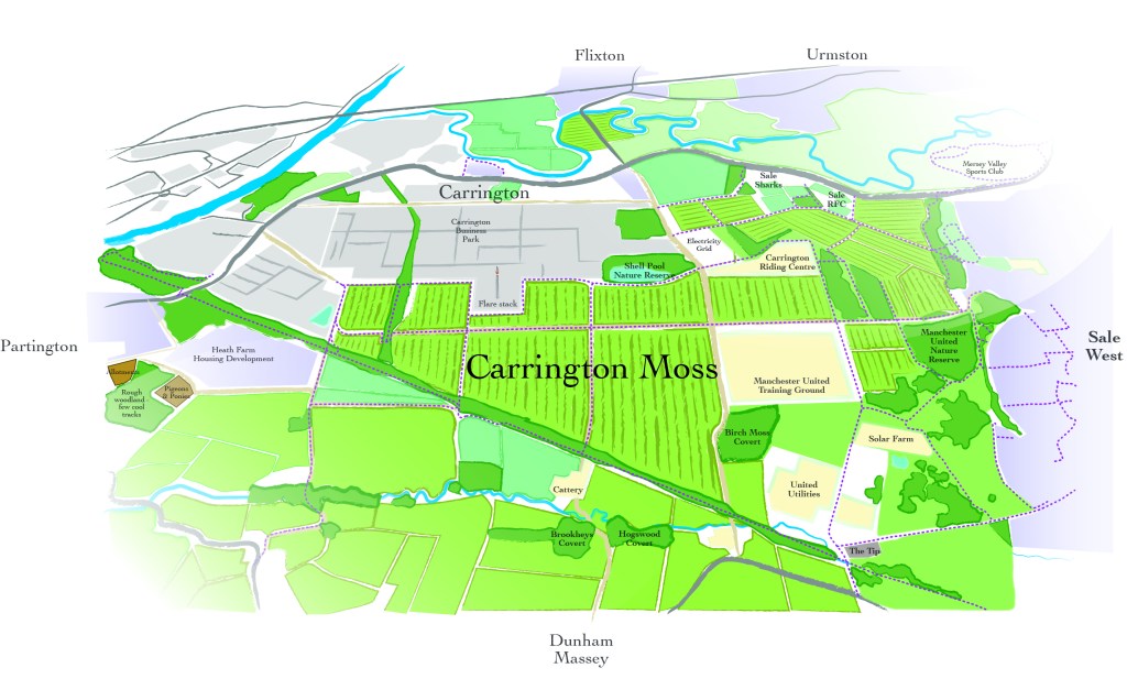
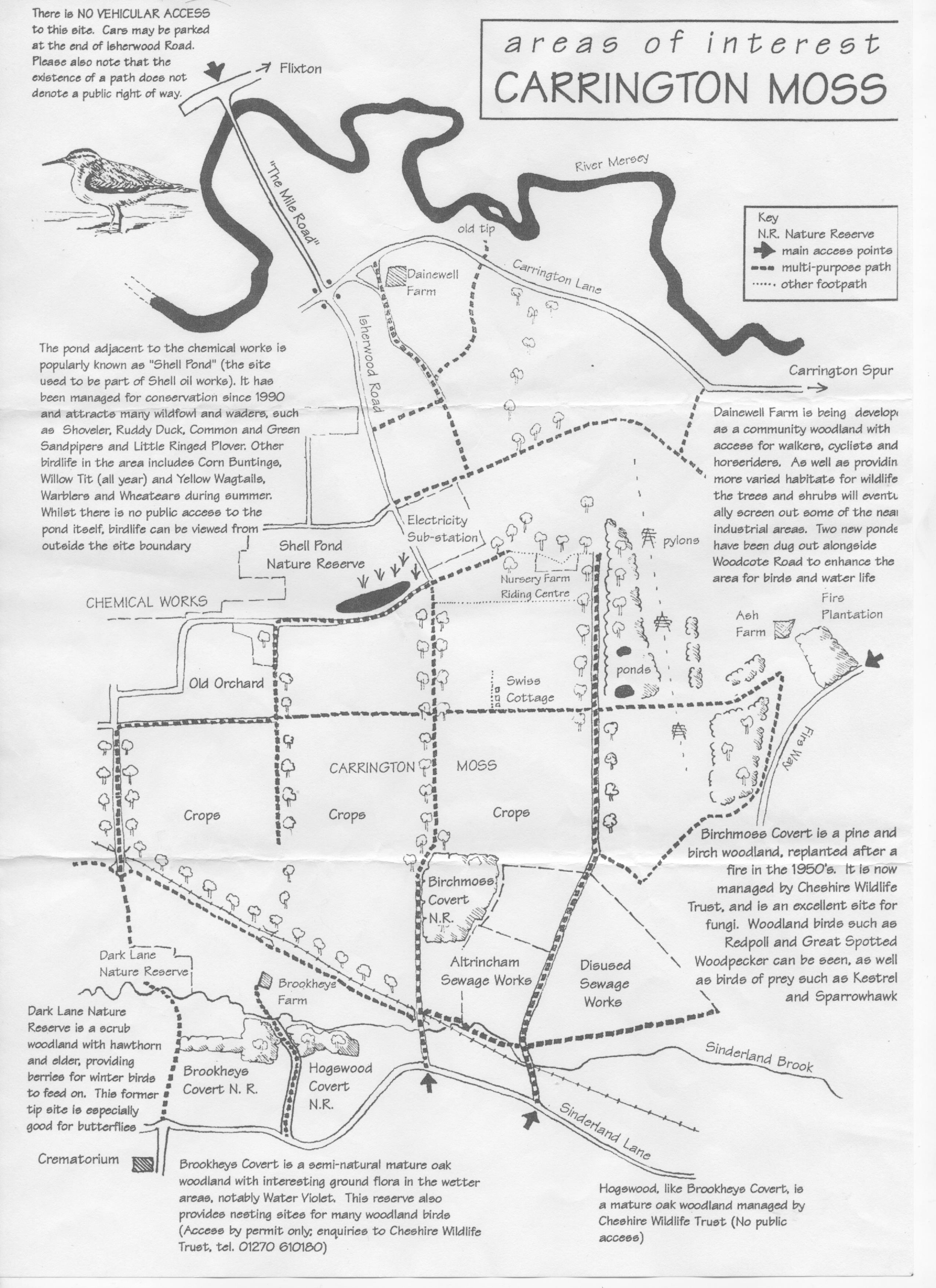
Carrington Moss
There are lots of different maps available to us on line. We have included a selection of links here and you can scroll down for more maps that specifically feature Carrington Moss.
Help us to develop our own local map
At our public meeting on 28th October 2020, we worked with residents to review the current map of Carrington Moss and to add to the features that are shown. This will help those visiting the Moss and will highlight the importance of this wonderful local green space. Suggestions were made at the workshop and the high level version of the map can be downloaded so members can propose further ideas for inclusion. You can either contact us with your ideas, using the button below or download of the map, print it out and write on your suggested features, photograph it and email the image to us.
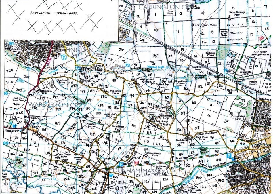
Other Local Maps
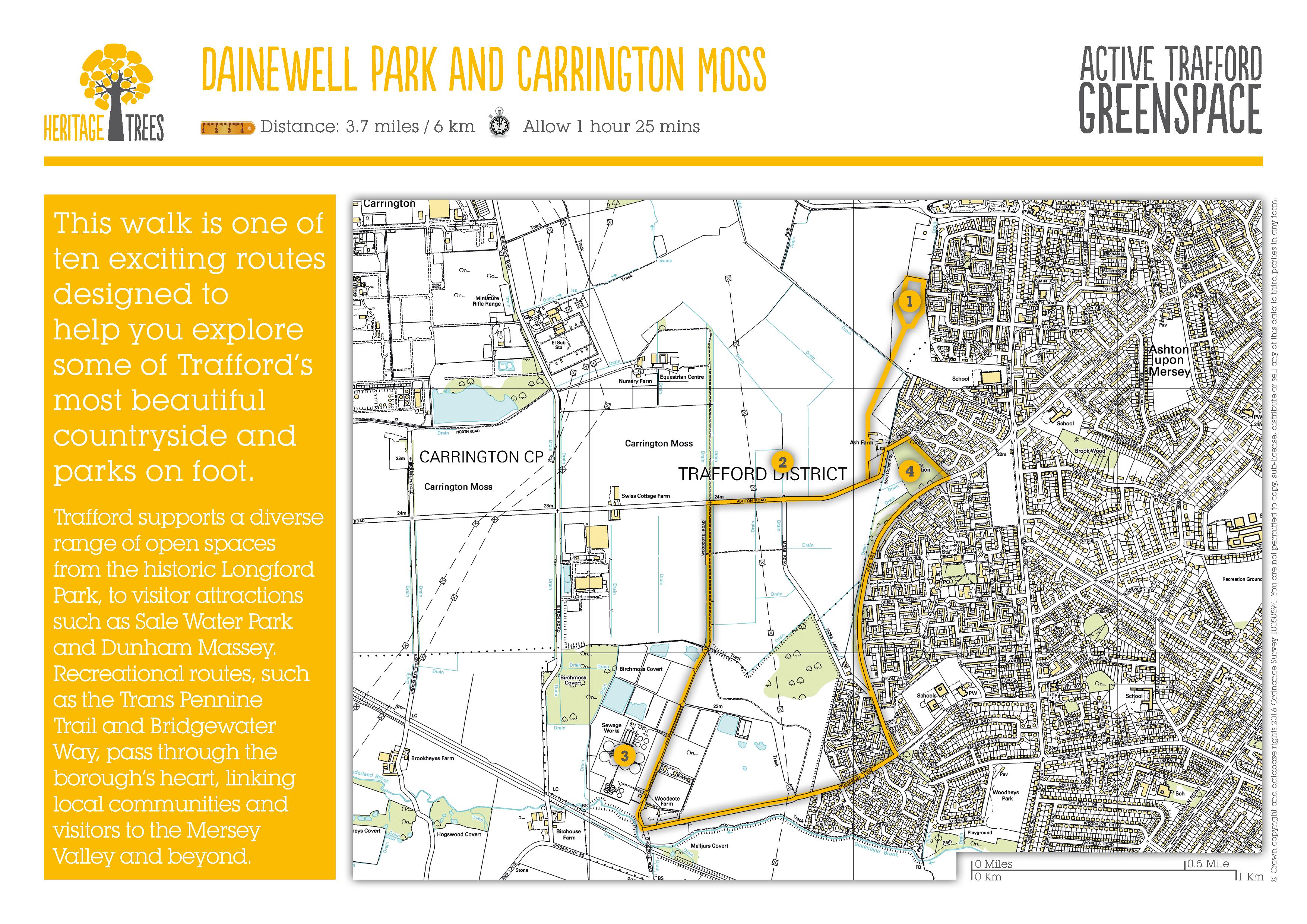
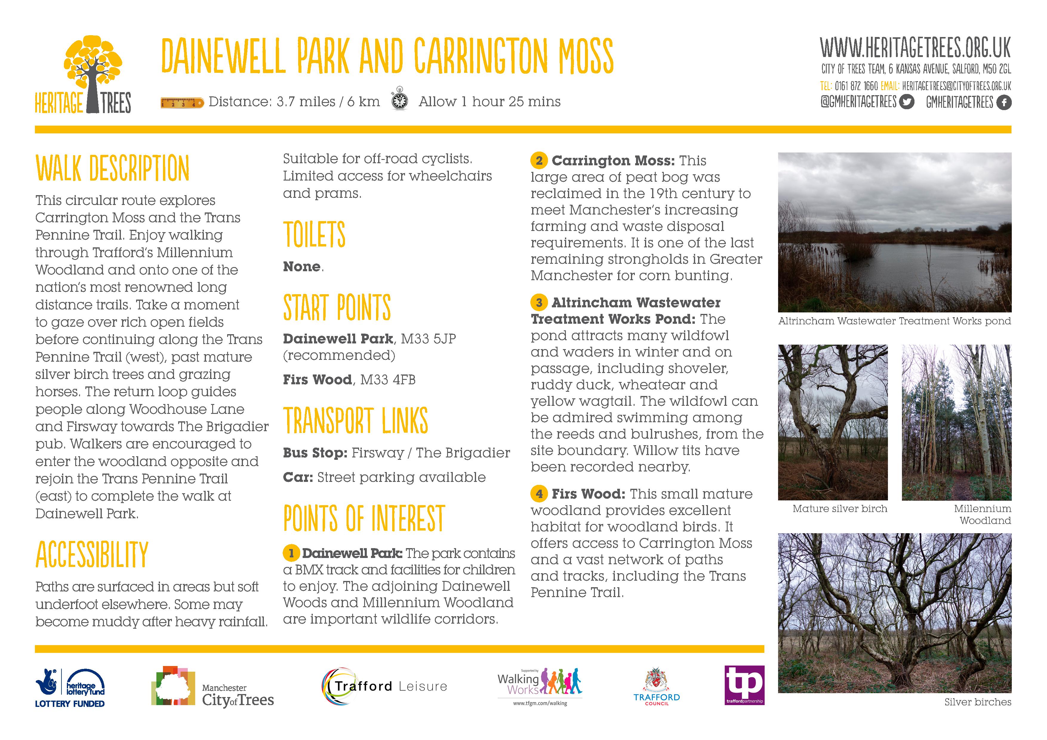
Dainewell Park and Carrington Moss
This walk is one of ten exciting routes designed to help you explore some of Trafford’s most beautiful countryside and parks on foot.
Manchester Birding Map
Areas of Interest Carrington Moss

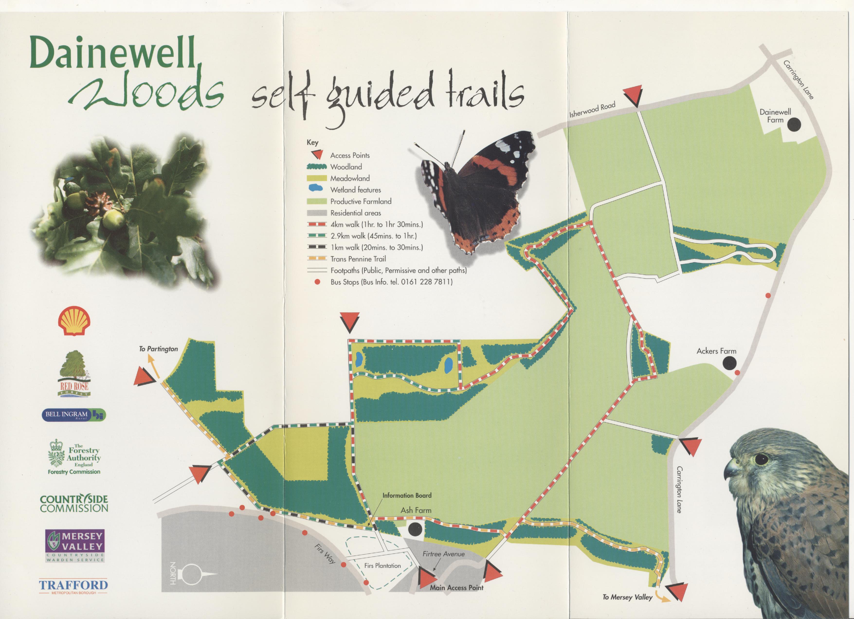
Dainewell Woods Self Guided Trails
Trans Pennine Trail

The journey through Trafford stretches 14km (8.7 miles ). Entering from Warrington across the River Bollin, along the former Heatley Skelton Junction Disused Railway to Cinderland Crossing, Broadheath. This section was opened in 1998 and is managed by the Bollin Valley Partnership.
The route continues northwards along Dairyhouse and Sinderland Lanes to Carrington Moss. It passes through Dainwell Woods, a woodland resource owned by Shell UK up to Carrington Lane. The route continues along Banky Lane to a bridge across the river Mersey at Carrington Spur. The route continues along River Mersey and follows Kickety Brook to link Hawthorn Lane, Stretford to the Bridgewater Canal. This section of the Trail is managed by Mersey Valley Countryside Warden Service on behalf of the Council. The route continues eastwards along River Mersey into Manchester through to Chorlton Water Park.
Within the Trafford area there are a number of car parks along the route: off Henshall Lane in Dunham, of Baltic Road/Atlantic Road at Broadheath, off Banky Lane – Ashton on Mersey, at Sale Water Park, Hawthorn Lane, and Turn Moss. (courtesy of the Things to do and see in Manchester website)

You must be logged in to post a comment.